Contents
Index
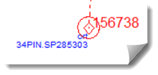
Reference Marks
Cadastral reference marks is generally placed close to a parcel corner and connected to the corner by a short radiation.
Its purpose is facilitate the replacement of a corner should the original marking be destroyed.
Reference mark connections do not play any part in the adjustment process.
ADDING REFERENCE MARKS
The importance of preservation or recording of survey marks is gaining more importance
and GeoCadastre™. Has been modified to facilitate this.
In many projects but more particularly road and rail jobs there is often a requirement
to keep a record of survey marks which might be threatened with interference during construction.
If a mark is coded in GeoCadastre™. As a Reference Mark (it will have a double circle
icon to illustrate this status) a warning is issued when attempts are made to join
to the RM to help avoiding incorrect connections as RM's are very often very close to cadastral corners.
The need to record RMs is usually in relation to the parcels likely to be impacted by
engineering construction so in general the process would be to construct, complete
and adjust a cadastral fabric first and then upon examination of the route of the
project record the RM's & PM's likely to be impacted.
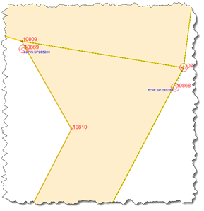
1. Using the survey plan as a guide go along the proposed route of the project and add
to the joined fabric the details of the survey marks likely to be threatened by the project.
Examine the cadastral fabric together with the survey plans relevant to it and select
cadastral points to which RM's are attached with the EXTRA TOOLS>Reference Mark tool.
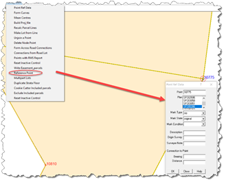
1 Accessing the RM Tool
2 Detail from the Survey Plan
3 Populating the RM Detail
4 RM Detail Displayed
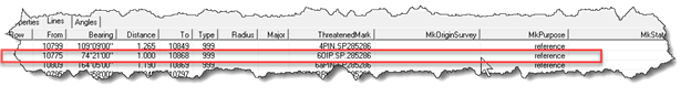
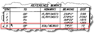
5 Lines table Extract Showing RM Added
The details entered into the Reference Mark tool have been inserted in the
appropriate fields in the Lines Table.
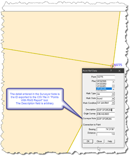
The Description field can be left blank but it is the details input for Surveyor Note
which are exported to the Threatened Mark report.
Note also that in the example provided here the "Note" column header has been edited
to "ThreatenedMark" in the config file Geodata uses.
DO NOT EDIT THE Note line in the config file
  <name>QLD</name>
    <attribute>
      <number>8</number>
      <Heading>ThreatenedMark</Heading>
      <extendedAttribute>
        <name>Note</name>
        <value>0</value>
        <type>VT_BSTR</type>
      </extendedAttribute>
      <editType>Edit</editType>
    </attribute>
Threatened Marks
See this topic for more information